Prev
Next
Locale: Wyoming
The Washakie Badlands are part of the Washakie Basin in Wyoming, which is located about 30 miles south of Green River City, WY, where the railroad crosses the Green River.
Chromolithograph #143 depicts the same area. QFD Pl.39. Tweed 2003 Exhibition n.41. Image is a direct scan of the Systematic Geology plate.
Prev Next
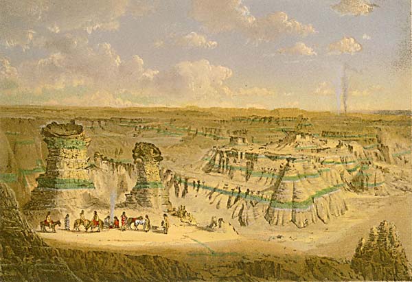
#150. Washakie Bad-Lands - Wyoming.
6 x 8.5, chromolithograph. Title on plate. This chromolithograph is Plate XV in Clarence King's Systematic Geology, published in 1878 as part of the record of the United States Geological Exploration of the 40th Parallel, 1867-1872. The plate is one of ten based on sketches by Munger, who was a guest artist of the survey. See this site page for more complete information.The Washakie Badlands are part of the Washakie Basin in Wyoming, which is located about 30 miles south of Green River City, WY, where the railroad crosses the Green River.
Chromolithograph #143 depicts the same area. QFD Pl.39. Tweed 2003 Exhibition n.41. Image is a direct scan of the Systematic Geology plate.

Prev Next
© Michael D. Schroeder 1 Sep 1999; Updated 20 May 2019.